Transform Your Surveying Capabilities
Our LiDAR drone services deliver unprecedented efficiency and accuracy while integrating seamlessly with your existing workflows.
Complete days of traditional surveying work in just hours. Cover 100+ acres in a single flight with comprehensive point cloud data.
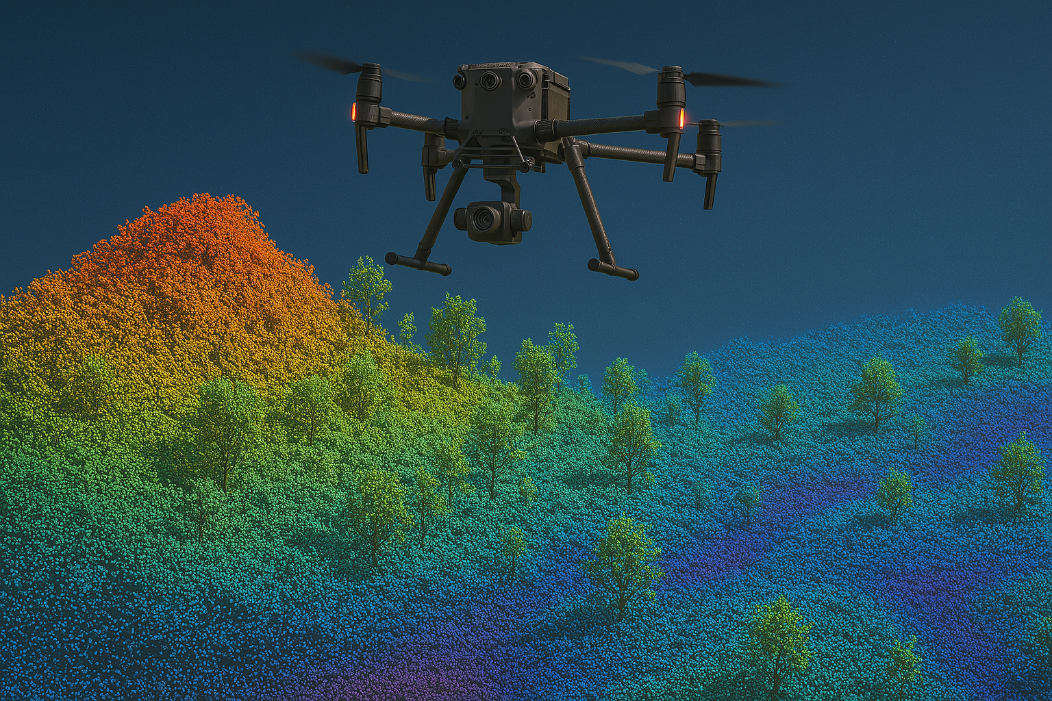
Achieve centimeter-level precision across entire survey areas, including points under vegetation that traditional methods would miss.
Expand your service catalog with high-value LiDAR surveys without the overhead of equipment investment and specialized training.
Survey hazardous or difficult-to-reach areas without risking staff safety, while capturing more comprehensive data.
Reduce labor costs while charging premium rates for specialized LiDAR surveying services and 3D deliverables.
Attract new clients in sectors requiring advanced 3D mapping like energy, infrastructure, and government projects.
The Numbers Don't Lie
Our LiDAR drone technology delivers measurable improvements for surveying businesses.
Reduction in field time
More data points collected
Vertical accuracy
Acres per day
Seamless Integration With Your Business
We handle the technical aspects of LiDAR drone surveying while you maintain client relationships and deliverable control.
We work with your team to understand project requirements, timeline, and deliverable specifications.
Our specialists handle all flight planning, regulatory compliance, and equipment preparation.
Our certified pilots conduct the LiDAR drone survey, ensuring comprehensive data collection.
Raw LiDAR data is processed, georeferenced, and quality-checked by our technical team.
You receive clean, classified point cloud data ready for integration into your existing workflows.
We can provide additional deliverables like contour maps, DEMs, or 3D models based on your needs.
Real Results for Surveying Companies
See how our LiDAR drone services have helped surveying businesses like yours.
Challenge: A 5-mile corridor survey with tight deadlines and complex terrain.
Solution: LiDAR drone survey completed in 2 days versus the estimated 3 weeks for traditional methods.
Result: Significant reduction in field time, comprehensive dataset including areas traditional crews couldn't safely access.
Challenge: Detailed topographic survey of a 50-acre urban redevelopment site with limited access.
Solution: Single-day LiDAR drone survey with minimal ground control points.
Result: Substantial cost savings while delivering more comprehensive data than originally specified.
Challenge: Accurate elevation data needed along 3 miles of riverbank with dense vegetation.
Solution: LiDAR drone survey that penetrated vegetation to capture true ground elevations.
Result: Superior data quality that traditional methods couldn't match, leading to a long-term service agreement.
State-of-the-Art LiDAR Drone Technology
We invest in the latest technology so you don't have to.
Our fleet features industry-leading LiDAR sensors capable of collecting up to 500,000 points per second with multiple returns for vegetation penetration.
Centimeter-level accuracy through real-time kinematic and post-processed kinematic GPS solutions integrated with our drone systems.
Advanced drone platforms with extended flight times capable of covering large areas efficiently while maintaining data quality.
Multispectral and RGB imaging capabilities to supplement LiDAR data when needed for comprehensive site documentation.
Our Service Area
Based on the Sunshine Coast, we provide LiDAR drone surveying services throughout South East Queensland and Northern New South Wales.
Sunshine Coast, Queensland
Our strategic location allows us to efficiently serve the entire South East Queensland region and beyond.
- • Brisbane
- • Gold Coast
- • Sunshine Coast
- • Toowoomba
- • Ipswich
- • Byron Bay
- • Tweed Heads
- • Lismore
We serve clients throughout South East Queensland and Northern NSW, with the ability to mobilize quickly for projects across the region.
Common Questions
Answers to questions we frequently hear from surveying professionals.
Ready to Transform Your Surveying Business?
Schedule a demonstration or discuss how our LiDAR drone services can integrate with your specific workflow.